Monday, July 25, 2011

Sometimes the heat just can’t be beat! Unfortunately, we learned that lesson the hard way last week when we both came down with heat exhaustion and ended up in the ER in Newton, NJ. But I’m getting ahead of myself! Rest assured - we are both doing fine now, but allow me to take you back in time, back to Bethel, PA, where we last left you…


Day 93
501 Shelter to Port Clinton, PA (22 miles)

After a great night at the 501 Shelter, where we hung out with many fellow hikers and a humongous watermelon, we headed out early. Having received a restaurant recommendation, we thought we would add a few extra miles to our day and get to Port Clinton for the evening. A long, hot day later, we arrived, but we weren’t able to find the restful evening we’d hoped for. The food was pretty awful, and we were treated in a way that made us feel uncomfortable (a.k.a. "hiker-unfriendly"). Eager to leave that establishment behind, and in order to get fuel for our stove, we had to walk 2+ miles on the highway to an enormous shopping center. This was a major culture shock for us – not to mention, once we got to the shopping center, the parking lots themselves added another half-mile or so of pavement-walking. At the end of a long and hard day, we were not in good spirits. By the time we made it back to the park where we set up camp, it was already time for bed. “Tomorrow is a new day,” we kept telling ourselves.

Day 94
Port Clinton, PA to Eckville Shelter (16 miles)

A new day indeed! A climb out of Port Clinton took us past some incredible views of Pennsylvania farmland from above - The Pinnacle and The Pulpit, to name two. Then onto Eckville Shelter, where we were glad to arrive early in the day to a cold shower and a relaxing afternoon. Like the 501 Shelter, Eckville is just off the trail, with a caretaker and running water – a welcome set-up for hot afternoons.

Day 95
Eckville Shelter to Bake Oven Knob Shelter (17 miles)

Today we hit some of those famous Pennsylvania rocks we had heard so much about. Boulder-hopping and balancing along the rocky "Knife's Edge" ridge-line made our hiking a bit slower, but more rewarding. As long as you watch your step (and if you're fortunate enough not to be on the exposed rock in the heat of the day), this kind of walking can actually be fun. We camped at a quiet campsite, a few yards away from Bake Oven Knob Shelter, where some guys had taken over and were setting off fireworks (less quiet).

Day 96
Bake Oven Knob Shelter to Palmerton, PA (7.7 miles)

A short morning of hiking led us to Palmerton, PA, a wonderful trail town, featuring the so-called "Jailhouse Hostel." It's not actually a jailhouse but the town's old municipal building, where they let hikers sleep in the basement bunk-room, free of charge! It was a hot day in town, but we were able to get some great food and enough ice cream to keep us cool on a 95-degree day (Claude's Creamery - you are well loved).

Day 97
Palmerton, PA to Leroy A. Smith Shelter (16 miles)

If you look at an elevation map of the Appalachian Trail, you might notice that north of Palmerton, PA the incline gets CRAZY for a good 2 miles. Commonly referred to as one of the hardest climbs on the AT, the trail leads you straight up a bald rock-face, where a zinc-smelting operation in the area left heavy metal residues, making it devoid of vegetation. The EPA closed the plant a few decades ago, and declared the mountain a Superfund site. Up we went over the "SuperFUN" site, as Zack likes to call it. And indeed, we actually did find it pretty fun, despite all the negative hype. We got out early, and were at the top of it by 6:15am, well before the heat of the day and in time for the sunrise over Palmerton. The rest of the day was flat and easy, and we made it to camp before 1:00pm, just in time for a nap!

Day 98
Leroy A. Smith Shelter to Delaware Water Gap, PA (21 miles)

Today was our 7-year anniversary! Yay! To celebrate, we decided to get to Delaware Water Gap earlier than expected by tacking a few extra miles onto our hiking day. It was a long, hot day at the end of the 230 miles in Pennsylvania, which we ultimately decided we had thoroughly enjoyed. (Despite the frequent complaints about the state's rocks and heat, we had generally mild weather and we thought the rocks weren't as bad as they were made out to be. I had originally planned to include here a poem about my feelings on Pennsylvania - perhaps entitled "Pennsylvania Rocks!"- but decided against it.) We pulled into DWG by 3:00 where we checked into the Presbyterian Church of the Mountain Hostel for another night of incredible hospitality (the church opens its doors daily to smelly hikers). Yummy treats in a mail drop from our parents and an enormous banana split at the old-fashioned ice cream emporium in town rounded out the day.

Day 99
Delaware Water Gap, PA (0 miles)

The heat was picking up, and we were grateful to be spending most of our day indoors and not on the trial. We had a great lunch at the Apple Bakery and a leisurely afternoon of eating and sitting in air conditioning (when possible). Topped the day off with another enormous sundae at the ice cream emporium.

Day 100
Delaware Water Gap, PA to Mohican Outdoor Center (10.5 miles)

One hundred days on the trail today! Or...one hundred days since we started our journey, which includes the days we have taken full "zero" days. We celebrated by crossing the Delaware River and entering New Jersey! In what would begin a series of unfortunate events, I was feeling a bit nauseous, but I chocked it up to all the dairy (see: ice cream emporium) that we'd had in DWG. We took it slow on our 10-mile day, which was increasingly hot, but incredibly beautiful. We walked by the glacially-formed Sunfish Pond and enjoyed the Jersey ridge-walking. We arrived at the Mohican Outdoor Center in time for lunch, where we were able to rest in the shade and wait out the heat of the day before heading back to our campsite. I still felt a bit funny at the end of the day, but was able to eat and drink normally, so I figured with a night of good sleep, I'd be as good as new...little did I know what awaited us on Day 101!

Day 101
Mohican Outdoor Center to Rattlesnake Mountain (10 miles)

Thinking we could outsmart the heat that was expected to reach its peak today, we woke up at 4:00am and left the Outdoor Center by 5:00. We had sweat all through the night, as the heat hadn't let up, and we were sweating within our first few steps on the trail. We caught an amazing sunrise from the top of a fire tower looking over the valleys below, and we pressed on, making good time, and thinking ourselves very wise for getting up early. Around 9:00, Zack asked if we could take a break because he wasn't feeling very well. We ate a small, salty snack, drank water and pushed on. At 10:00 we stopped again. This time, Z was spent. Recognizing the signs of heat exhaustion, we found a shady spot on the trail and tried to rest. I don't want to go into too much ugly detail, but I'll say that once the vomiting started, we knew it was time to call 911. Since we were in the woods, a good six miles from the nearest paved road, it took a few more hours of trying to keep Z cool, resting and hydrating before the first ranger showed up, followed by a very friendly EMT and his helpers. They surrounded Z with ice packs to bring his body temp down, and in time, he was able to gain enough strength to walk out the mile to where the ATV waited, ready to escort him to an ambulance. Once we boarded the ambulance, we were taken to Newton Hospital, where he was hooked up to an IV, and got some color back into his cheeks. It was then that I started to feel funny, and my feelings of nausea from the last 48 hours - which I must have suppressed in the adrenaline rush of making sure Zack was going to be OK - came back with a vengeance. I thought I'd ask the nurse about it, and in the middle of my questions, it was my turn to vomit...not a lovely story, I know, but looking back, the timing could not have been better. I was already in the ER, the safest place I could be, so I signed in, and then it was my turn to get an IV. My first time in an emergency room, and my first time in a hospital bed! What a day.

Since our misadventures on Day 101, we have been hanging out in Branchville, NJ resting and trying to get some food and water back into our systems. I had one more bout with the nausea after leaving the hospital, but Zack has been solid as a rock since. Three full "zero" days here (Days 102-104), where we have been joined by Zack's "Uncle Danny," who drove us around and helped us find unlikely sources of air conditioning (why not spend an afternoon at ShopRite?) and kept us great company. Now that the oppressive heat wave has broken, we are excited about getting back on the trail tomorrow and easing ourselves back into the swing of things.

We are so grateful to the wonderful people who have helped us out (including MaryAnn, who gave us a ride to the library today to keep us from going stir-crazy), and we're glad to have made it 1,300 miles without too many hitches. We were due for one, I guess!

Less drama next time, we promise.

Love and happy trails,
Lara (and Zack)

PS - Check out our new pictures on our Flickr photostream by clicking on the thumbnails above.

Wednesday, July 13, 2011

Pennsylvania! Ahoy there, blogosphere. First, let me apologize for the lack of pictures in this post. You can see all our recent photos by clicking on one of the thumbnails at the top of this page. It should direct you to our flickr stream, which has every photo we've taken. Also, I apologize for not posting this when it was originally written - last week! Yikes! Lara will have a new update written tomorrow to catch you up to where we are now...since this blog post is about the week before last. Oops!

I'm writing from Bethel, PA, which is less than 1000 miles from Mt. Katahdin in Maine. We've just resupplied at a Mennonite discount store thanks to a tip (and a ride) from Bob, the caretaker at the 501 shelter up closer to Pine Grove. The store was packed at 3:00 on a Wednesday! Guess that answers the question of when the entire town of Bethel does their grocery shopping. Since we last blogged from D.C. we've completed two more states: West Virginia (itty-bitty mileage there) and Maryland (not quite as bitty). Friend Colin joined us for most of his home state of MD, and even resupplied us by the side of the road a day after we parted ways. Never thought I'd be able to eat a piece of cheesecake in 90 degree weather and then continue hiking, but, with Colin's help, we made it happen. Still working on his trail name, though Tenderfoot the Tenderfooted and O'Sheanendoah are in the running.

We've probably heard more opinions about Pennsylvania than any other state (save maybe Virginia), most of them negative. Granted, most of the state is flat as a pancake and littered with rocks. A native commented to us, "yes, it's rocky, but at least we're nice!" Nice they are.

It's all about perspective and mental fortitude at this point in the game though, and, with only about 2 months of hiking left, we're doing our best to make the most of it. Our journey has taken us by old mining towns, behind hedgerows, through cornfields and into some brilliant little towns. PA, you're A-Ok!

On a side note, I've started pinning down birdsongs. There's one bird whose song is the first few notes of "On Broadway," and another who sings "I barely learned the tune" from Simon and Garfunkel's "So long, Frank Lloyd Wright"--ornithologists, please chime in.

Here's the lowdown:

Day 83
Town's Inn, Harpers Ferry to Rocky Run Shelter (15.4 miles)

Hiking out of Harpers Ferry on July 4th with Colin in tow. An easy day out of the gate after our relaxing visit to l'otel Boyd in D.C. Meandered along the C&O towpath, spotted nice views of the Potomac and the Shenandoah rivers and spent the night at a gorgeous new shelter.

Day 84
Rocky Run Shelter to Raven Rocks Shelter (20.6 miles)


Our first and only full day in Maryland. We climbed to the top of the original Washington Monument (circa 1827), but our view of the surrounding area was obscured by fog. Still, grabbed a great photo of Colin inside this bottle-shaped tower. Due to rocks, heat, and blistered feet, Colin called it a trip late in the day. We miss him!

Day 85
Raven Rocks Shelter to Rocky Mtn. Shelter (19.8 miles)

Craggy descent this morning as we sped toward the Mason-Dixon line and into PA. If you're looking for an introduction to the Appalachian Trail, give yourself 4 nights and take on Maryland: the terrain is gentle, water can be found at numerous state park spigots and history abounds.

Day 86
Rocky Mtn. Shelter to Toms Run Shelters (19.2 miles)

Made the mistake of sleeping in a small shelter at Rocky Mtn. Turns out the structures do a pretty good job of keeping heat in. We waddled sweatily to the next shelter just in time to beat the rain. Met several hikers pushing on to Pine Grove Furnace State Park to attempt the half-gallon challenge (more on this later) but decided to hold off until we were nearer to indoor plumbing.

Day 87
Toms Run Shelters to Allenberry Playhouse, Boiling Springs, PA (23 miles)

Passed the half-way point today! Met a few former thru-hikers--Blue and Evergreen--who made us sandwiches and let us huddle under their tarp while a downpour set in. Really looking forward to repaying all this trail magic someday. Since we were soaking wet and desperately in need of a shower we decided to push big miles into Boiling Springs. A fellow at the ATC regional office there let us in on a secret: the Allenberry Playhouse and Resort offers rooms to hikers for $40, well below their usual rate. We pounced on the deal and, while we had to skip the production of "Hello Dolly" (next time!), had a great time exploring the tiny town.

Day 88
Boiling Springs, PA to Cove Mt. Shelter (21.5)

Began the day with a 12-mile walk through backyards and farmland. I had had some anxiety about this walk for some time because of the level of exposure to sun it carried. Fortunately we were able to get an early start and beat the heat. Met a swell section hiker, Reid, and his scrumptious dog, Goose, at Cove Mtn. He's hiking southbound so we were able to offer him some useful advice. Nice to talk trail with someone who isn't as immersed as we are.

Day 89
Cove Mt. Shelter to Doyle Hotel, Duncannon, PA (4.1 miles)

Strolled down the mountain into Duncannon this morning, caught a ride to the grocery (thanks Timone!) and commenced the half-gallon challenge. An old AT tradition, the challenge--eating a half-gallon of ice cream, unassisted, in one sitting--commemorates the passing of the half-way point. My strategy? Neapolitan ice cream. Completed the challenge in 33 minutes and didn't lose any of it. In fact, I went about eating as usual for the rest of the day. That's a hiker appetite!

In other news: "Billville," a generous group of AT enthusiasts, had thrown a "hiker feed" here two days prior. Lots of folks we hadn't seen in a long while hitched forwards or backwards to attend, so we were overwhelmed by a spontaneous reunion of sorts. The Doyle Hotel, over 100 years old, has become a must for thru-hikers. Not the best accommodations we've ever had, but the food was good and the people were super.

Day 90
Duncannon, PA to Peters Mtn. Shelter (11.2 miles)

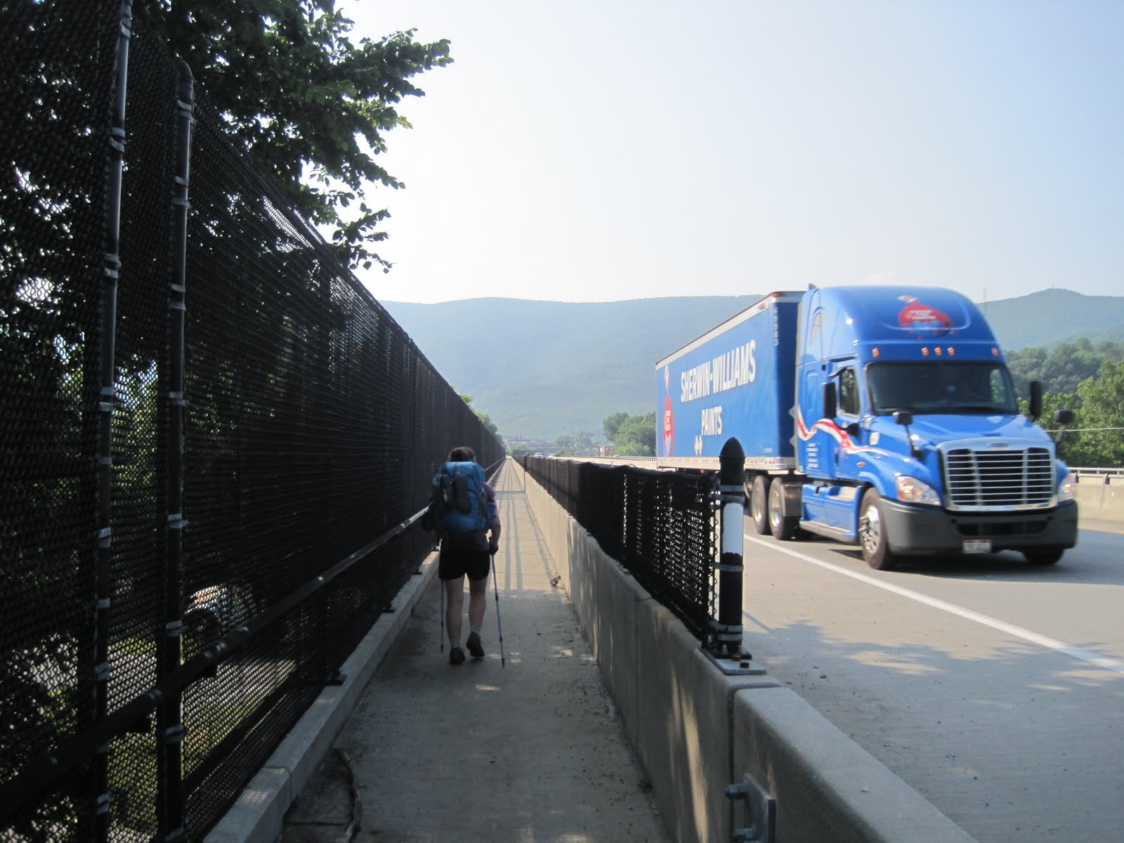
Easy day out of town. Started with a huge breakfast in town and then onto our longest highway walk yet, over the Susquehanna, was full of cobwebs. A train came along the tracks just as we were leaving town, and we got a pretty cool video of it. An early day into the shelter, and a hot afternoon.

Day 91
Peters Mtn. Shelter to Rausch Gap Shelter (18 miles)

Walked through an old mining community today, so we hear. Saw a bear, thinner than the ones we saw in SNP. Guess there are fewer pic-a-nic baskets in central PA. Camped in a gorgeous spot by Rausch creek that reminded us why we're out here.

Day 92
Rausch Gap Shelter to 501 Shelter (17.5 miles)

Battled gray skies and unchanging terrain this morning but persevered! Looking forward to our night at the famous 501 Shelter, an old potters studio complete with bunks, a solar shower, and a skylight. Really enjoying the opportunity to stop by so many towns in PA. These are definitely places we never would have made it to otherwise. Shout out to George, Kathy, Chip and Gillian Goodrich--we're right near your old home of Reading!

We're likely going to "zip" through a few states in the next few weeks. Meeting up with Mama and Papa Ezor in NYC in no time!

Love,
Zack (and Lara)

Sunday, July 3, 2011

We joined the 1,000-mile club! Whooooot! It's hard to believe, but we've made it to West Virginia, and have now completed almost half ofthe Appalachian Trail. A lot has happened since we left Charlottesville, and we've covered a lot of ground (averaging 20 miles a day for 10 days straight). We've evenupped our "bearcount" from zero to six.
Here's what our adventuring has brought us:

Day 71
Fish Hatchery Road to Harpers Creek Shelter (12.2 miles)

After cousin Lindsay dropped us off in Montebello, VA, we headed back up the steep trail with full hearts and stomachs (lots of good eating and family time in C'ville did us good). All afternoon, a storm seemed to loom over us as we conquered "The Priest" and descended its neverending downhill. The storm never really showed, though, and we made it safely and dryly to Harpers Creek Shelter.

Day 72
Harpers Creek Shelter to Paul C. Wolfe Shelter (22 miles)

A gray day with lots of stops and starts...to be honest, I'm not bringing to mind anything exciting from this day, but I'm sure it was great at the time!

Day 73
Paul C. Wolfe Shelter to Blackrock Hut (25 miles)

Our longest day yet! For real this time! We entered Shenandoah National Park around mile five of the day, only to realize that we had passed the station where we were supposed to register
and fill out a permit. Zack dropped his pack and ran back the one mile to the register,filled it out, and ran back. So, not to brag about him or anything, but he did a 27-mile day. Look out!

Day 74
Blackrock Hut to Hightop Hut (21.4 miles)

We resupplied early in the day at a camp store in the park. It's been really nice knowing that there are camp stores scattered around where we can get food, so we don't have to carry too many days-worth at a time. A warm day of hiking was topped off by some roadside trail magic (brownies and bananas). After dinner that night, we both still felt hungry, making us come to the frustrating realization that after multiple 20-mile days in a row, we weren't carrying enough food for our appetites. That all was to change...

Day 75
Hightop Hut to Big Meadows Campsite (20.4 miles)

We had our first bear sighting today! Well, there was a black furry flash across the trail (think: the Smoke Monster on "Lost"), and we're pretty sure it was a bear. We decided to experience the side of the park that most people experience, so we stayed at a paid campsite tonight. It was a bit strange to have a perfectly flat site on which to set up our tent, with an enormous bear-box included, and showers nearby. Most people
were camped next to their cars, but, still, we fit in nicely. A leisurely walk along a nature trail to theBig Meadows Wayside led to an enormous dinner. We ate the following desserts: chocolate sundae, blackberry milkshake (a Shenandoah National Park staple), blackberry cobbler and pecan pie (with ice cream on the side of both). We also ordered dinner.

Day 76
Big Meadows Campsite to Pass Mountain Hut (18.8 miles)

Today was the first day that we felt a little peopled-out in the park. So many friendly faces to talk to, but sometimes on the trail you want things to be quiet and peaceful. We remained in good spirits though, and had a mac and cheese dinner with a jolly
turtle.

Day 77
Pass Mountain Hut to Front Royal Terrapin Station Hostel (22.7 miles)

We knew we had a long day ahead of us, and it was going wonderfully until...a huge storm moved in when we were only one mile from the hostel where we planned to stay the night. We tried to get there by nearly running, but we couldn't
outrun the weather. We got drenched, and then - in a surprise twist on a 90-degree day - got hailed on as well! Ultimately, the storm passed quickly, and we arrived at Terrapin Station Hostel, the basement of a former thru-hiker converted into a bunk-house, and got dry and clean.A peaceful night under a roof was just what we needed.

Day 78
Front Royal Terrapin Station Hostel to Dick's Dome Shelter (19 miles)

With so many days doing over-20 miles, a 19-miler seems short! We got into camp by 3:00 and had a wonderful afternoon (naps included). Despite the 30+ youngsters camped nearby, we had a restful night. Though, I shall always remember the insane amount of mashed potatoes I had to eat tonight, when Mr. Z was not feeling well enough to eat his fair share. I mean, I like mashed potatoes and all, but nobody needs nine cups in one sitting...

Day 79
Dick's Dome Shelter to Bear's Den Hostel (18.7 miles)

The "roller coaster" is a 13-mile section with 10 significant climbs and descents, feared and revered by hikers past and present. We knew we had Bear's Den Hostel, a literal castle in the woods, to look forward to at the end of it, so we powered through it. (And, not to sound too cool, but we didn't find the "coaster" too taxing.) Pizza, Ben and Jerry's and a hiker room open 24/7 at Bear's Den made for another wonderful night.

Day 80
Bear's Den Hostel to Harpers Ferry, WV (19.7 miles)

Within the first few miles of the morning we crossed out of Virginia! After 500+ miles in that state, we finally made it to a new state. We also crossed the 1,000-mile mark! It was a joyful morning indeed. We made it to the Appalachian Trail Conservancy Headquarters in Harpers Ferry, WV and had our official picture taken for the records. The real treat was when Colin and Esther braved the DC traffic to come and pick us up. A Thai take-out dinner back in the big city was just what we needed to adjust to city living for a few days.

Day 81
Washington, DC (0 miles)

Food and friends! Food and friends! It was a beautiful day in the capitol. I met up with Becca, Whittie extraordinaire, and had a great afternoon with her. Colin's parents also invited us over to their house for a delicious homemade dinner. Our errands were also successful...we showed up at the camera store with our supposedly broken camera, and - on cue - it started working again. Yay!

Day 82
Washington, DC to Harpers Ferry, WV (0 miles)

More errands to do today before we leave the spoils of the big city. Two zero days after long miles has made us happy hikers.

As we head back onto the trail tomorrow, we've got lots to look forward to. Many more state crossings (Maryland and Pennsylvania, here we come!), and new boots to break in. We're still loving the hiking life, and are grateful for all of the love and support that surrounds us.

Love to all,
Lara (and Zack)

Tuesday, June 21, 2011

Another brief hiatus to visit family plops us in Charlottesville, VA for two days this week. After another 5-day stint of big miles and big climbs, we find ourselves plucked off the trail and whisked to Blenheim Vineyards, home to Caroline and Andrew. Pretty sure we're the only thru-hikers in our bunch who've been treated to wine tastings, tours of UVA, and dinners at the outdoor mall. Feeling extremely lucky yet again.

The past few hiking days have been a recoup period for us: temps a little cooler, regaining our pre-beach stamina, etc. We managed to average around 19 miles a day for this outing thanks to a strategy of early rising and getting our big climbs over with in the morning. Overall, we're feeling good and are very much looking forward to hitting the Shenandoahs and (dare I say it) the end of Virginia within the next two weeks. 814.8 miles down!

Here's the day-by-day:

Day 64
Daleville to Bobblets Gap Shelter (18.5 miles)

Fairly normal day--cool and dry--but abnormal for the same reasons. Our hike was easy enough, following the Blue Ridge Parkway (BRP) for a large section, traversing it several times. Had a struggle getting our bear hang up, but it's all comical in retrospect. Met a new friend today named Bruce from Honolulu who told us all about shrimp farming, working for JPMorgan's International Division and lobbying for Common Cause. Everyone's got their story out here.

Day 65
Bobblet's Gap Shelter to Cornelius Creek Shelter (18.6 miles)

We were lucky enough to encounter not one but two instances of Trail Magic today. The first, a cooler left for us on the trail, contained sodas, candy and delicious, home-made zucchini bread. Happily munching our new-found snacks, we decided to postpone our usual morning snack until later in the day. Little did we know, just around the corner from our delayed food break sat Johnny Cash and Flatbread, two past thru-hikers who had brought a veritable cornucopia for all passing hikers into the woods near Jennings Creek. "We'd received so much trail magic during our hikes," said Johnny, "we just had to repay it." And repay it they did. These folks went above and beyond our expectations, making us pancakes on the spot, loading us up with fresh fruit, chocolate, and sodas, and even offering to replace our headlamp batteries. Admittedly, we walked away with upset stomachs. Still worth it.

Day 66
Cornelius Creek Shelter to Johns Hollow Shelter (21.6 miles)

Began the day with a scaling of Apple Orchard Mountain. The summit, at 4,225 ft. is the highest point we'll reach until New Hampshire. The bald-top is home to an airforce radar facility that gives off a serious Dharma Initiative vibe (and, I guess, the views are worth noting too). On the back side of the mountain near Thunder Ridge we braved the Guillotine, a large boulder suspended directly above the trail and, later, crossed the James River via footbridge (the longest foot-traffic only bridge on the AT).

Day 67
Johns Hollow Shelter to Brown Mountain Creek Shelter (18.3)

Steep climb this morning up Bluff Mountain and the Punchbowl, but we tackled it no sweat. It seems the heat wave might be making a comeback, so we're sticking to our early-rise mantra for the next few days. Got into camp around 2:30, so we enjoyed a lazy afternoon dipping in a nearby swimming hole and reading aloud. Evening rain doused the area, but we managed to stay dry thanks to the rain fly.

Day 68
Brown Mountain Creek Shelter to Spy Rock Rd./Charlottesville, VA (19.3)

A foggy morning, the likes of which we haven't seen since Tennessee. Started out the day with a 3,000 foot climb up to a few balds (Cold Mountain, Tar Jacket Ridge) but, alas, they were viewless. It's a strange feeling looking out into the void and knowing that, on a sunny day, you could see for miles and miles. On top of one of the balds, Lara gained cell phone reception for long enough to coordinate our pick-up with Caroline. Excited by the prospect of a family dinner that evening, we bounded over the ridge, making great time. Met cousin Caroline in Montebello, VA around 3:30 and made it to C'ville by 5:00.

Missing you all as we creep closer to the half-way point. Pray for good weather, and drop us a line sometime!

Love,
Zack (and Lara)


Tuesday, June 14, 2011

We're having a heat wave! And what a week it's been. It was not an easy task adjusting back to trail life after a week with family and joyful celebration at the beach (Days 49-53). It didn't help that the temperatures soared, and the mileage was not "easy Virginia," as we had been told. As a result, I have become one big heat rash, and we're both covered in bug bites - these are a few of our favorite things! In spite of some trying times and a minor case of the "Virginia Blues," we are still pushing onward, enjoying the company of our fellow hikers, and seeing some incredible sights.

Here's what's happened since we left the beach!

Day 54
US-52 to Helvey's Mill Shelter (2.3 miles)

The morning after Caroline and Andrew's wedding was a gray and rainy one. We all decided it made it easier to leave such a wonderful place and time with family after such a beautiful wedding. After a long drive to Bland, VA, we said a tearful goodbye to my parents and hiked a short two miles back into the woods. It was the first night since we started hiking that we were the only people at a shelter. This worried us a little bit - have all of our friends gotten so far ahead? Has the trail become a ghost-town? Where is everybody? A strange feeling, but we didn't have it for long.

Day 55
Helvey's Mill Shelter to Dismal Falls (18 miles)

My blister-free days are behind me. After not having developed a single one in 55 days, I took off my shoe tonight to find a doozie. The reason? I got a pedicure at the beach in preparation for the wedding, and it took off all my hard-earned callouses! The price of luxury! The blister didn't slow me down though, and our first day back we did a long, 18-miler to Dismal Falls, which were actual anything but dismal. The waterfalls were not listed as anything spectacular in our guidebook, but we were so glad we checked them out. We also ran into some old and some new trail friends - so happy to see familiar faces, and the peaceful sounds of the nearby waterfalls also helped to soothe us back into trail life.

Day 56
Dismal Falls to Woods Hole Hostel (13 miles)

Originally, we had thought, "If we just spent a week off the trail, we won't need another hostel or town stay for at least a week afterward." Well, that was until we read the description of Woods Hole Hostel in our guidebook as "a little slice of heaven." Sure enough, after a hot but short 12-mile hike, we arrived at the hostel to home-baked goods and friendly people. The hostel was built in the 1980s and has since become a family business, now run by the granddaughter of the original founders. The hostel has its own vegetable garden and bunkhouse; everyday fresh and local meals are made for guests. A communal dinner of delicious homemade bread, pasta and salad with 20 fellow hikers was just what we needed. (Topping it off with the locally made Butter Pecan ice cream didn't hurt either.)

Day 57
Woods Hole Hostel to Campsite (15 miles)

Breakfast at Woods Hole continued to reinforce the idea that we were experiencing "a little slice of heaven." With our tummies full, we headed into the hot day and hiked into the town of Pearisburg, VA. There we got our fill again, this time on Mexican food at La Barranca restaurant, and resupplied at the grocery. Being in town made us so thankful that we hike in the woods and not on pavement; as hot as it is under the trees, it is truly unbearable in towns. So hot! The only remedy (obviously) was a dip cone and a Blizzard at the local DQ before heading back out into the woods. We got a little lost trying to get out of town, but - thanks to our college degrees - we were able to figure it out. We had a very steep, long uphill climb to our campsite, but we made it there before dark. Just after we arrived, a group of 16 from Tallahassee - mostly boy scouts and a church group - showed up too! It was great to see some young people and families on the trail amid the scruffy thru-hikers.

Day 58
Campsite to Bailey's Gap Shelter (19 miles)

We arrived at Bailey's Gap Shelter after slowly making our way up a very steep hill in our last mile of a long, hot day (the longest mile of my life!). Exhausted, we set up camp and heard big thunder rolling in. Sure enough, a huge thunderstorm raged right overhead for over an hour. It was a pretty scary experience. We've had relatively few storms out here, but the ones we have had have been intense. We held up well and were able to sleep through the night in spite of it.

Day 59
Bailey's Gap Shelter to Laurel Creek Shelter (14.5 miles)

A bit shaken by the previous night's storm, we were a bit slow-going this morning. Another enormous climb in the afternoon zapped us of our energy, and we decided to cut our day short at 14.5 miles, rather than pushing on to 21 miles. Thunder threatened all afternoon, but unlike the night before, nothing became of it. Still, we were able to have a much-needed leisurely afternoon at the shelter with some of our friends - Mr. Tree, Jugs, John Stamos, Danish and Gravy.

Day 60
Laurel Creek Shelter to VA 620, Trout Creek (21.3 miles)

Let me tell you, the heat did not let up! We tried to get an earlier start this morning, but even still, by 1:00, the heat was unbearable. We stopped with some of our fellow hikers at Niday Shelter at lunchtime and took a hikers' siesta. I fell asleep on the shelter floor in the shade and couldn't have been happier. By 3:00 we were able to head out again; the clouds had moved in, so the sun's rage had diminished its hold over us. We put in a solid 8 miles after lunch and were able to make up the mileage that we had cut short the day before, arriving in time for an evening around the campfire with friends and their dogs (Luna and Kiwi - these thru-hiking dogs are very hardcore, but we still love Milo and Casey most of all).

Day 61
VA 620, Trout Creek to Catawba Mountain Shelter (15.8 miles)

Great things in store for us today! Within the first 6 miles of hiking, we reached Dragon's Tooth, a huge rock that juts upward out of the top of a mountain. We each scaled the steep monolith and got to the top for our photo-ops, of which we were very proud (don't worry moms, we were very, very careful!). It was a very rocky day of hiking, more boulder-climbing than I like (my short legs, try as they do, have a hard time in these sections). Mid-way through the day, many of our hiker friends were spreading their excitement about the legendary Home Place restaurant in Catawba, VA, a one-mile hitch from an upcoming road crossing. We hadn't planned on going to eat there that day, but we couldn't resist. After hiking 13 miles, we arrived at The Home Place, a beautiful old home restored as an all-you-can-eat soul food restaurant, which attracts people from all around. Even with the vegetarian version (very confusing to our waitress), we had our fill...far more than our fill, actually. The two-mile hike back out was an experiment in stomach-stamina. (Zack's wins; mine loses.) Still, worth it.

Day 62
Catawba Mountain Shelter to US-220, Daleville, VA (17.8 miles)

We woke up before 6:00am today! This is a big deal for us, but as it gets hotter, it will have to become a habit. By 7:00 we got to McAfee Knob, one of the most famous spots on the A.T. A rock juts out over the side of a mountain with "the best view in Virginia," and another amazing photo session. Waking up early also made it possible for us to hike the 18 miles into town before 3:00. Thankfully, there was a great breeze today, which made hiking not only bearable, but quite pleasant! Dinner at the Daleville Pizza Hut, and splitting a pint of ice cream from the BP was the perfect way to chill after a hot week on the trail.

Day 63

Daleville, VA (0 miles)

We decided to relax and take the day off in Daleville. It's not a fancy place, but it's got what we need. Of course, the heat wave has continued to give us a break now that we are no longer hiking (the high today is a perfect 75). It's a gorgeous day, and while we've got a few errands to run, we're mostly planning on cashing in our free-doughnut coupons and sitting by the Howard Johnson Express swimming pool (believe it or not, it's a very happening place).

I can feel our spirits lifting already, as our rashes, blisters and bug bites get a reprieve from the sweaty last few days. In the next week, we'll finish the section of Virginia described as "rugged," and enter the Shenandoah National Park, which is supposed to be absolutely beautiful, and a bit easier on the hiking legs. A lot to look forward to!

Love to all!
Lara (and Zack)

Tuesday, May 31, 2011

A vacation from our vacation. We cooked our last Knorr Side, broccoli cheddar rice, on the side of the road at the intersection of the Appalachian Trail and U.S. 52. Fourty-eight days and 584 miles after beginning our trek, we'd managed to land at this junction within two hours of our desired rendezvous time. Proud of ourselves for executing our plans so flawlessly, we sat in the shade refusing offers to hitch into town. We had our own, special hitch on the way. And lo, just as anticipated, a shiny black Toyota, filled to the brim and piloted by two smiling, sunglassed figures, pulled up the dusty gravel drive right on time. Lots of hugging ensued. For a brief moment, our on-trail lives and off-trail lives converged. We took pictures, walked a few yards of the trail. Then we dashed for the air conditioning. (For those of you born after 1987: why is it that whenever I try to be pithy in a blog post I sound like I'm writing a xanga entry about how much I love the lineup on TGIF?)

Anywho. The Goodriches were kind enough to meet us near Bland, VA (real name, I promise) and whisk us away to Duck, NC where Caroline Goodrich and Andrew Ornee are getting married (if either of you are reading this post after the wedding, congrats guys!). We're honored to be here to share in the celebration and grateful to have a beach vacation within our mountain vacation. I guess it's kinda like this.

We'll be spending days 49-55 visiting, eating chocolate frogs and fizzing whizzbees (thanks Mom and Dani), and washing everything we own. Looking forward to a rejuvenating respite. Despite the change of scenery and the easier terrain, many hikers suffer from the "Virginia blues" during this portion of the trail. We're feeling lucky to have 100+ miles of the state under our belts and a chance to refocus after this week off. When we return, we'll be carrying less weight (bye-bye winter gear) and hopefully rejoining some of our friends who we'd gotten ahead of.

By far the biggest highlight of the past week was our day and a half in the Grayson Highlands. If you live in south-central Virginia and haven't had the chance to visit this state park, please add it to your "must list." Imagine you're on the set of The Sound
of Music, add in a few dozen feral ponies and you'll have it.

Here's what we've done since Damascus:

Day 41
Damascus, VA to Lost Mountain Shelter (15.8 miles)

Sure feels good to be back on the trail. We love our off days but start to get antsy after too long. Ate some vegan jerky with lunch today that was absolutely delicious--really hit the spot.

Day 42
Lost Mountain Shelter to Thomas Knob Shelter (12.2 miles)

Dramatic weather! Last night at Lost Mountain was particularly serene and this morning was no different. As we set off to climb White Top and Mt. Rodgers, we were backed by birds chirping beneath blue skies. Soon, however, the sky began to turn hazy, then gray. Exasperated, we tried to hurry to the shelter, but it was out of reach. Buckets of water and tiny bits of hail drenched us to the bone. Within minutes the trail became a river. Mountain weather, you are fickle! Post-storm, however, the landscape opened up into something akin to the Swiss Alps. A stranger shouted, "Dudes! There's like 10 wild ponies over here!," a
lerting us to the presence of a great photo op. We spent the night (and weathered another storm) safe under the tin roof of Thomas Knob Shelter with some snoring firemen and some loquacious day-hikers. Oh, and in case you're keeping tabs or planning a hike yourself, Thomas Knob is up there in the Top 5 shelters with amazing views.
Day 43
Thomas Knob Shelter to Hurricane Mountain Shelter (16 miles)

A perfect day. The trail was even-tempered and well-graded. The skies were forgiving (save a bit off noontime heat), and the natural world was full of light. We ran into our second group of ponies right off the bat, and they were eager to interact with us. One licked, then nipped Lara's leg, but it was all in good fun. We found a glorious spot for lunch--a single, shady tree amidst miles of mountain grasslands near the 500-mile mark. One of our favorite days yet.


Day 44
Hurricane Mountain Shelter to Partnership Shelter (19.7 miles)

After an uneventful 19.7 mile hike we arrived at Partnership Shelter, adjacent to the Mount Rogers Recreation Area headquarters. Called "the Taj" by thru-hikers, this shelter has a built in shower and acts as nearby phone from which you can order pizza. We dug the place, but weren't fans of how crowded it was.

Day 45
Partnership Shelter to Davis Path Campsite (14.3 miles)

After 11 miles in the morning, we decided to stop in at "The Barn" restaurant for lunch near Atkins, VA where the trail crosses I-81. Our waitress, Carol, revealed at the end of our meal that she was a three-time thru-hiker and encouraged us to stay and wait out the oncoming thunderstorm. We took our sweet time, resupplying at the nearby Exxon station, drinking coffee and chatting with other hikers. Hours passed, but no rain fell. Sure enough, though, just as we decided to take a chance and leave, ominously dark clouds rolled in. We turned right back around, sat back down in the restaurant and waited out the downpour. Made it to camp during a window long enough to set up our tent and stay dry.

Day 46
Davis Path Campsite to Knot Maul Branch Shelter (11.3 miles)

This day may go down as one of our hardest, even though it was technically on the easy end. We had planned an 11.3 mile day--kids' stuff compared to what we've done by now. Unfortunately, we underestimated our reliance on our morning coffee and were feeling sluggish without it. (Zack felt doubly lethargic after getting a worrisome bug bite and deciding to take a Benadryl at 9:00 in the morning.) Our short days always seem to feel the longest. Maybe it was just the week catching up with us, but we crashed as soon as we arrived in camp. The day was not without enjoyment, however. An especially outgoing bunny visited us several times as we ate dinner. It was obvious he'd been fed by other hikers. Mixed feelings about that, but happy to have a cute critter around nonetheless.

Day 47
Knot Maul Branch Shelter to Jenkins Shelter (19 miles)

Climbed a big'un to the top of Chestnut Knob this morning, where we had lunch in an
old fire warden's cabin. An afternoon that looked tame on the elevation map turned out to be nothing close to easy, and we wiggled our way over rocks and gnarly roots. Thankful to have have a hiking partner on these hot Virginia days. Encouragement is where it's at.

Day 48
Jenkins Shelter to U.S. 21/52 (11.7 miles)

Left camp at 7:00 this morning and flew to our meet-up spot. Dinner in Chapel Hill--delicious pizza and salad. Craig and Andie G. even let me drive (an honest thrill after 7 weeks of traveling no faster than 3.5 miles an hour). Looking forward to a week's worth of sleeping in a real bed.

Love you guys,
Zack (and Lara)

PS - We finally added little pictures to the previous blog post, so check them out! (Also, Lara wants you to know it's OK if you don't get the "xanga" reference. She doesn't either.)

Saturday, May 21, 2011

We walked to Virginia! Yesterday morning we crossed the Tennessee-Virginia border and have made our way to Damascus, "the friendliest town on the trail."
It's been quite a week since Asheville, with many ups-and-downs, figurative and literal. We did two 22+ mile days, and we trudged through rain and cold, but we are very grateful for the last two days of sunshine, and for a full "zero" today in Damascus.

Here's what we've been up to:

Day 32
Erwin, TN to Curley Maple Shelter (4.2 miles)
After a great time in Asheville, we headed back to the trail. As we drove, heavy gray clouds moved in, and we learned that the forecast showed five days of rain ahead of us. We decided to press on nevertheless, and had a pleasant and short hike to a shelter just outside of Erwin. Just after we arrived, the downpour started and didn't let up all night. We were happy there was room in the shelter, and that our good friends, Avo and H.I.P., had also braved the elements.

Day 33
Curley Maple Shelter to Clyde Smith Shelter (22 miles)

Our longest day yet (until later in the week)! Phew. The weather was not fun (to put it nicely). We trudged through pouring rain and slogged up slippery slopes, but we made it the whole 22 miles. Once we got to the shelter, a heavy fog moved in, and the night turned cold, but thankfully we were able to stay warm and relatively dry in the shelter.

Day 34
Clyde Smith Shelter to Overmountain Shelter (14.4 miles)

Oh, the wind and the rain! We climbed Roan Mountain, one of the highest points on the A.T. and the coldest part of the trail in the South, year-round. (We were very thankful this week to have our cold weather gear with us; some of our friends had already sent theirs home, thinking that the multiple 80-degree days we had had last week meant that the warmth was here to stay...not so fast...) We also climbed over many balds, from which the guidebook tells us there are many great views, but we were lost in a cloud of white and couldn't see anything. We made it to Overmountain Shelter (an enormous, old barn converted into a shelter in 1986) for another cold, drafty night.

Day 35
Overmountain Shelter to Mountaineer Shelter (18 miles)

And the rain kept coming! Today was the day of "mud-skating." The trail was muddy the whole way, and almost all of our clothes were soaked from the previous days of rain. I was so eager to get to the shelter by the end of the day, that we pretty much ran there for the last hour. Staying warmtook some effort, but we were able to salvage one pair of dry-ish items each and get some sleep.

Day 36
Mountaineer Shelter to Dennis Cove [Kincora Hostel] (15.6 miles)
The thought of dry clothes must have motivated us down the mountain today, because we made it to Kincora Hostel fast. Though it wasn't actually raining, the trail was still muddy, and the air was still cold. We arrived at Kincora, a unique, low-key hostel with two bunk-rooms and a kitchen, supported by "a suggested donation of $4 per hiker." We washed our clothes and dried off; it was so nice to be in a heated room! And then...they brought us free food! (A hiker's best friend is free food.) They had tons of leftovers from the weekend, when they hosted an annual event called Hard Core, where volunteers meet at Kincora and go out and do trail work along the A.T. They said the food "had to go," so we worked hard at that task for a while (salad, pasta, ice cream, soup - yum!).

Day 37
Dennis Cove [Kincora Hostel] to Vandeventer Shelter (17.5 miles)

After a big and luxurious breakfast of fresh fruit and cereal, we headed back out into the woods. First thing, we walked by Laurel Falls, a beautiful and enormous waterfall. It felt great to be hiking in weather that was not cold or rainy. The sun even made an appearance! We arrived at Vandeventer Shelter in time for dinner and a nice chat with some older thru-hikers. Given the favorable weather conditions, we were even able to set up the tent for the first time in a week!

Day 38
Vandeventer Shelter to Abington Gap Shelter (22.7 miles)

Our longest day yet (for real this time)! We woke up early to watch the sunrise from Vandeventer Shelter. We were above the clouds, so even though it wasn't clear enough to see the sun actually rise, we did get some great views. We headed out early, as we had a long day ahead of us. One thing we have learned on the A.T. is that "flat" terrain is never flat. Indeed, our "flat" day turned out to have lots of hills and climbs, but we did it, and the day was gorgeous. It makes such a difference to hike in nice weather.

Day 39
Abingdon Gap Shelter to Damascus, VA (10.2 miles)

Yesterday morning, we woke up early and headed out of camp, eager to get to town. We made great time, and crossed the state-line around 10:00am. Such a great feeling to know that we've walked from Georgia - through North Carolina and Tennessee - to Virginia! At this point we're almost a quarter of the way done with the trail (we hit the 500-mile mark next week).

Day 40
Damascus, VA (ZERO miles)

Today we plan on relaxing and relaxing. After receiving an awesome mail drop from home and from Zack's Colby friends, Colin and Esther, we stuffed ourselves yesterday with sweet treats. (In fact, we were so full that we had no room for dinner - crazy talk!) Today we're hoping to do less gorging, but still more eating (of the fruit and vegetable variety this time). We're sitting at Mojoe's Trailside Coffeehouse eating breakfast and sipping coffee, and we've gotten a few recommendations for good veggie burgers in town, so that's where you can find us.

We'll be in Damascus until tomorrow morning, and in the meantime, we're looking forward to giving our legs the break they deserve.

Love,
Lara (and Zack)